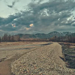
Anantnag
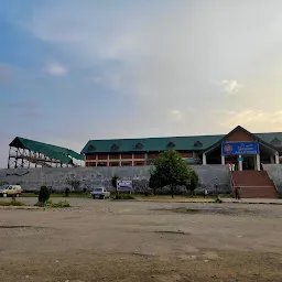
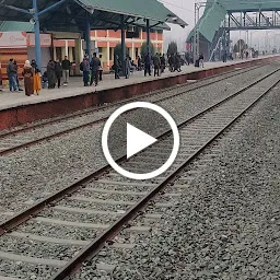
Railway Station Rd, Laram Jangi Pora, Jammu and Kashmir 192124Anantnag is a train station located in Kulgam, Jammu & Kashmir. The average rating of this place is 4.30 out of 5 stars based on 122 reviews. The street address of this place is Railway Station Rd, Laram Jangi Pora, Jammu and Kashmir 192124. It is about 0.00 kilometers away from the Anantnag railway station.
- Where is Anantnag located?
- Anantnag is located at Railway Station Rd, Laram Jangi Pora, Jammu and Kashmir 192124.
- What is the contact number for Anantnag?
- The contact number for Anantnag is +91 96228 25788
- What is the nearest railway station from Anantnag?
- Anantnag railway station is the nearest railway station to Anantnag. It is nearly 0.00 kilometers away from it.
Ankur Mishra 13 months ago
Anantnag railway station is a railway station on the Northern railway network. It is the headquarters of Anantnag division of Northern Railway zone. It lies in Firozpur division.
Its on the route to beautiful Valley and one has to alight here to visit Pahalgam
Farmaan Mushtak 21 months ago
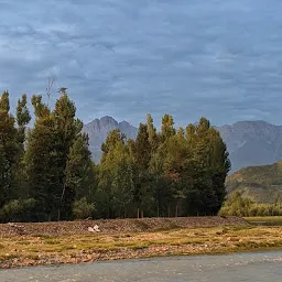
The Anantnag District is located in the Jehlum Valley's southern portion. The region has become synonymous with greatness as a result of its invigorating climate, the awe-inspiring magnificence, its tall mountains, the melodious flow of beautiful waters of its springs and sreams, the fertile soil, fragrant flowers, and delectable fruits.
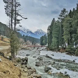
Geographically, the district can be found between 33 degrees 20 minutes and 34 degrees 15 minutes north latitude and 74 degrees 30 minutes and 75 degrees 35 minutes east longitude. Mountains and dense forests make up the entirety of the Southern sector of the district, which is adjacent to the tehsils of Reasi, Banihal, and Kishtwar in the province of Jammu, as well as the Eastern sector of the district, which is adjacent to the tehsil Kargil in the Ladakh division. Both of these sectors are contiguous with the Jammu province. This district is surrounded on all sides by the Pulwama district, with the exception of its westernmost portion, which is included of the Kulgam district. Anantnag is the district in the state that is home to the highest concentration of rivers and streams (Nallas), including names like Sandran, Brengi, Arpath, and Lidder. The Lidder river, which originates in Sheshnag lake and irrigates the greatest proportion of the district's land, is the most significant of these.
The overall landmass of the Anantnag district comes to 3,574 square kilometres (1,380 sq mi). The district is surrounded on all sides by other districts: to the east, it shares a border with Kargil district and Kishtwar district; to the south, it shares a border with Doda district and Ramban district; to the north, it shares a border with Ganderbal district; to the west, it shares a border with Kulgam, Srinagar, Pulwama, and Shopian districts.
SEH RAN 13 months ago
The town has been called by both the names Islamabad and Anantnag. The latter is characterised by Marc Aurel Stein as its "Hindu name".[6]
"Anantnag" derives from the name of the spring at the southern end of the town, whose sanskrit name Anantanāga was mentioned in the Nilamata Purana and other texts.[6] According to the Gazetteer of Kashmir and Ladak, it is named after Ananta, the great serpent of Vishnu and the emblem of eternity.[7]
The name Islamabad is believed to have derived from the name of a Mughal governor Islam Khan who built a garden in the area.[8][9]
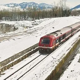
Anantnag (ANT) is a station on the 119 km (74 mi) long Banihal-Baramulla line that started in October 2009 and connects Baramulla (BRML) and Srinagar to Banihal (BAHL), Qazigund. The railway track also connects to Banihal across the Pir Panjal mountains through a newly constructed 11 km long Banihal tunnel, and subsequently to the Indian railway network after a few years. It takes approximately 9 minutes and 30 seconds for a train to cross the tunnel. It is the longest rail tunnel in India. This railway system, proposed in 2001, is not expected to connect the Indian railway network until 2017 at the earliest, with a cost overrun of 55 billion INR. The train also runs during heavy snow across the Kashmir Valley.
Both names are used for the town, Anantnag being preferred by the Hindus and Sikhs while Islamabad is preferred by the Muslims. The locals continue to use the name Islamabad, even though the Indian security forces deployed in the area from 1998 onwards frown on its use.[4][8][10]
During the Dogra rule, Anantnag/Islamabad was the headquarters of one of Kashmir Valley's three districts, which was referred to as the "Anantnag wazarat"Masjid Baba Dawood Khaki is among the oldest mosques in the city, being built around 1400 CE.[19]
The Martand Sun Temple is one of the important archaeological sites of Kashmir, built around 500 CE. It temple is situated at Kehribal, 9 km east-north-east of Anantnag and south of Mattan. This famous Sun Temple was destroyed by Ruler namely Sikander Buthshikan of Shahmiri Dynasty.[19]
In 2010 Anantnag was declared as major City of Export excellence with a total GDP of 3.7 billion $.[20] The high GDP of Anantnag is due to the centralised position and presence of high concentration of troops and migrant labours in it. Anantnag has a strategic position lying on the main North-South Corridor Road and with the highest number of tourist destinations it an economic hub of Kashmir Valley. The city suffered heavily during conflict times of the 1990s; many roads, bridges, and government buildings were reduced to ash. But in the 2000s, it made a quick recovery. It has been listed among 100 fastest economically developing cities.[20]
- Address
- Railway Station Rd, Laram Jangi Pora, Jammu and Kashmir 192124
- Phone
- +91 96228 25788
